User Interface
Window
The Cartographer App window consists of the following parts:
- Header (Top Bar) — contains the title and a dropdown menu button (see number 1 in Image 1).
- Sidebar (Right Panel) — contains tools for editing and navigation (see number 2 in Image 1).
- Main Working Area — the central editing space (see number 3 in Image 1).
- Footer (Bottom Bar) — displays status information about mdivs, page numbers, and zones (see number 4 in Image 1).
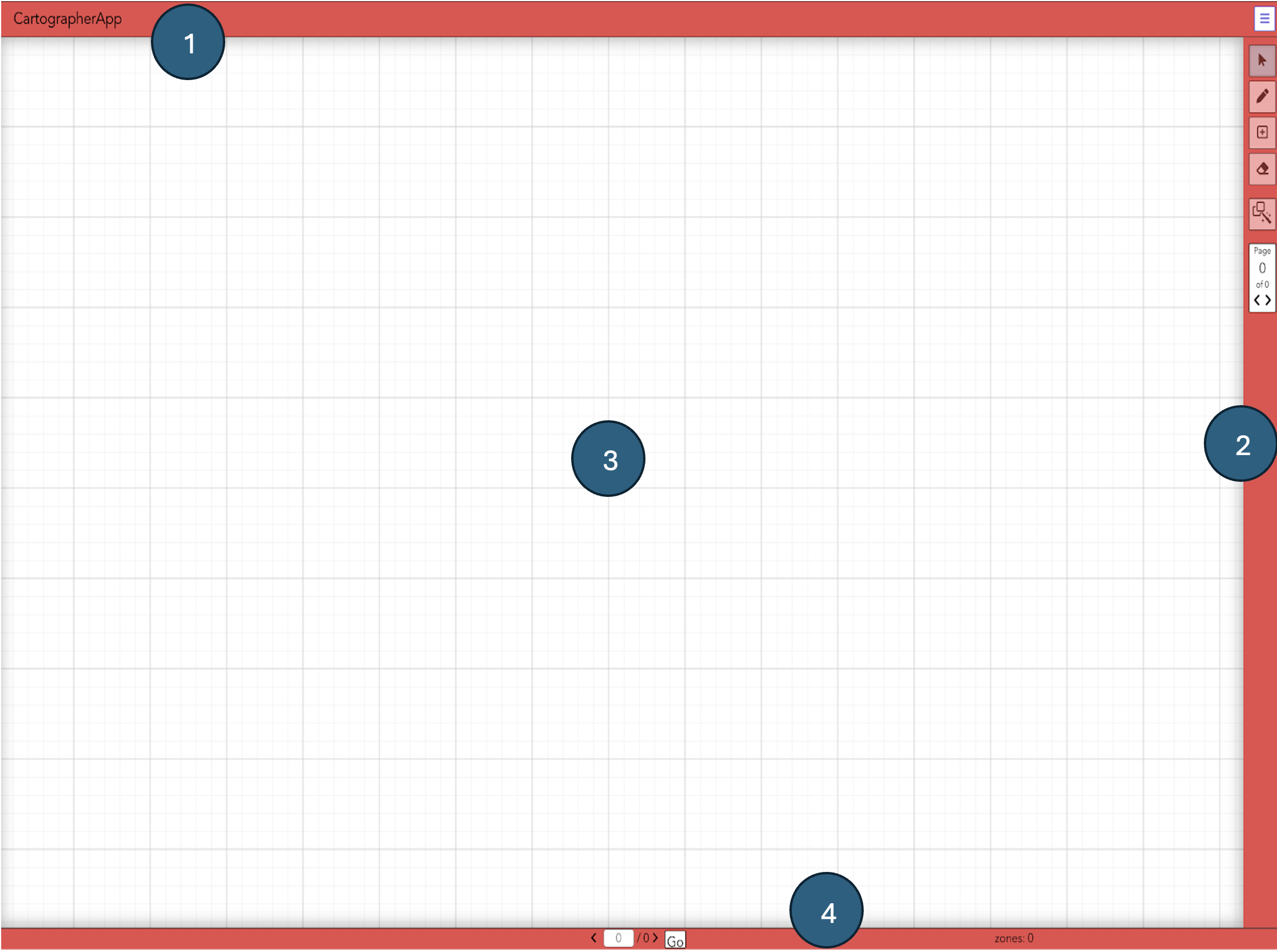
Image 1: Layout of the Cartographer App interface
Header
The header contains a title (see number 1 in Image 2) and a dropdown menu button (see number 2 in Image 2).
Clicking the menu reveals options for uploading or downloading MEI files, and importing IIIF image files.
Additionally, the header includes buttons to open the Page Overview and toggle the Measure List.
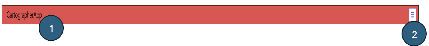
Image 2: Layout of the Cartographer App header
Menu Bar
Clicking the dropdown menu in the header opens five options (see Image 3):
- Upload MEI File — upload an MEI file from your local repository (see number 1 in Image 3).
- Import IIIF Manifest — import an IIIF manifest from a server (see number 2 in Image 3).
- Download MEI File — download a rendered MEI file from Cartographer (see number 3 in Image 3).
- Show Page Overview — display all imported images and add more images (see number 4 in Image 3).
- Toggle Measure List — show or hide a list of all movements and measures in a sidebar (see number 5 in Image 3).
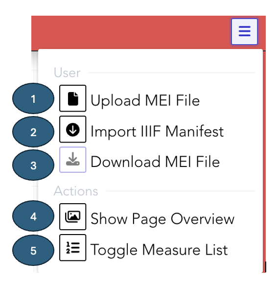
Image 3: Header Menu Bar
Footer
The footer contains:
- Mdiv status display (see number 1 in Image 9).
- Page navigation buttons (see number 2 in Image 9).
- Button to jump to a new page (see number 3 in Image 9).
- Zone counter — shows the total number of zones on the current page (see number 4 in Image 9).
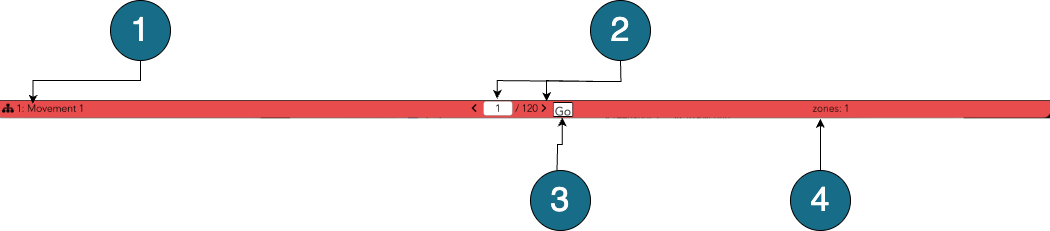
Image 9: Cartographer App Footer
Sidebar
The sidebar contains the following tools:
- Select Regions — choose and adjust existing regions (see number 1 in Image 10).
- Draw Rectangles — create new rectangular zones (see number 2 in Image 10).
- Add Measures to Zone — insert additional measures within the same zone (see number 3 in Image 10).
- Erase Measures — remove selected measures (see number 4 in Image 10).
- Automatic Measure Detection — run the detector to identify measures automatically (see number 5 in Image 10).
- Page Navigation — move between pages of the document (see number 6 in Image 10).
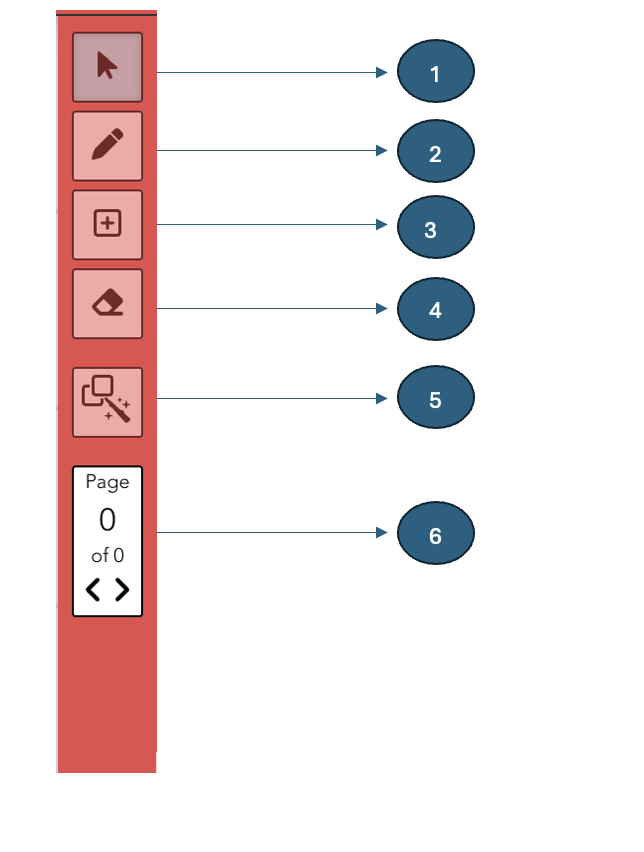
Image 10: The Cartographer App sidebar